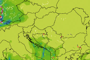
Extending the range of flood forecasting
With the launch of the Danube European Flood Alert System, countries in the Danube River Basin will receive twice daily forecasts and flood warnings for up to ten days.

The EFAS, based on LISFLOOD, combines medium-range weather forecasts from the European Centre for Medium Range Weather Forecasts, the German Weather Service and hydrological data from water authorities.
Flood waters can rise quickly, and a long-term forecast is vital to provide warning to evacuate residents or to minimise damage. advances in weather forecasting, flood protection models and rainfall radars can now be combined to increase the flood warning time for the Danube River Basin.
The European Flood Alert System (EFAS) provides national and regional water authorities with an overview of the flood situation in Europe. The Danube EFAS launches in December with catchment-based forecasts to give early warning for floods up to ten days in advance.
The EFAS is based on the computer model LISFLOOD,
which combines medium-range weather
forecasts from the European Centre for Medium Range
Weather Forecasts (ECMWF), the German Weather
Service (DWD) and hydrological data from water
authorities.
Additional tools for national centres. The EFAS is being developed by the EC Joint Research Centre (JRC) with the support of national meteorological and hydrological services. In the Danube Basin, an EFAS Memorandum of Understanding has been signed with Germany, Austria, the Czech Republic, Slovakia, Hungary, Slovenia, Romania, Bulgaria and Moldova. Negotiations are still under way with Serbia, Bosnia and Herzegovina and Croatia to become members. The EFAS-Danube programme will provide members with access to a protected web-server where EFAS forecasts will be updated twice a day.
The Danube-EFAS won’t replace national systems. Instead, it will work in parallel to provide national forecasting services with additional information in the form of earlier flood warnings. The Danube EFAS will be able to predict more accurately the risk of floods from three to ten days, and will help national and regional water authorities alert responsible staff, increase the local flood forecasting frequency or double-check systems and procedures used in crisis management.
An expandable system. The Danube-EFAS will be officially launched this December, but the system will continue to grow. “With better data, we can better calibrate the system and the quality will go up”, says Ad de Roo, Action Leader of Weather Driver Natural Hazards at the JRC. Experts are also working on incorporating a greater variety of weather forecasts, “so then you have a wider range of possibilities and a better overall picture of what might happen with different meteorological models”, says de Roo.
The JRC will continue to run the Danube-EFAS until 2009, when the operation of the system is expected to be transferred to a permanent home. Negotiations are under way to decide on this transfer, and Slovakia has expressed an interest in participating in the system’s management.
The increasing number of devastating floods in recent years has made it clear that effective advance action is needed to protect the environment, prevent human casualties and reduce material losses. Now through the Danube-EFAS, national forecasting centres will have extended warnings enabling them to act quickly.
Disclaimer
The information contained in the ICPDR website is intended to enhance public access to information about the ICPDR and the Danube River. The information is correct to the best of the knowledge of the ICPDR Secretariat. If errors are brought to our attention we will try to correct them.
The ICPDR, expert group members, nor other parties involved in preparation of information contained on this website cannot, however, be held responsible for the correctness and validity of the data and information provided, nor accept responsibility or liability for damages or losses arising directly or indirectly from the use of the information conveyed therein.
Only those documents clearly marked ICPDR documents reflect the position of the ICPDR.
Any links to other websites are provided for your convenience only. The ICPDR does not accept any responsibility for the accuracy, availability, or appropriateness to the user's purposes, of any information or services on any other website.
When using the information and material provided on this website, credit should be given to the ICPDR.
