More information and download links below the graphic.
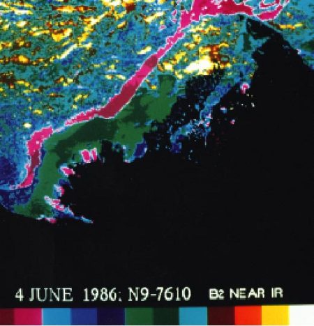
Advanced Very High Resolution Radiometer (AVHRR) satellite image (June 4, 1986) showing a color composite of the visible data band for the Mackenzie Delta River water overflowing the landfast ice can be seen as purple regions

Click here, or on the graphic, for full resolution.
Advanced Very High Resolution Radiometer (AVHRR) satellite image (June 4, 1986) showing a color composite of the visible data band for the Mackenzie Delta River water overflowing the landfast ice can be seen as purple regions
| Sources | Title (cont.) extending offshore from the mouths of channels. Dean, K.G., W.J. Stringer, K. Ahlnäs, C. Searcy and T. Weingartner, 1994. The influence of river discharge on the thawing of sea ice, Mackenzie River Delta: albedo and temperature analyses. Polar Res. 12: 93-94. Used with permission of K. Deans and K. Ahlnas. (AAR Figure 3.19) | ||||
|
Cartographer/ Designer |
|||||
| Appears in |
AMAP Assessment Report: Arctic Pollution Issues |
||||
| Published | 1998 | ||||
| Feedback/Comment/Inquiry | Contact webmaster | ||||
| Search for other graphics |
With related subjects Covering the same geographic area |
||||
|
Available Downloads
(please review use constraints above) |
|
||||
|
Citation/Reference Use constraints |
Please refer to the AMAP policy regarding use and reproduction of AMAP maps and graphics |
