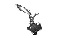
Data format: SDE Raster Dataset
Coordinate system: Indian_1960_UTM_Zone_48N
Location: Server=mekserv3; Service=5153; Database=mrc; User=sde; Version=sde.DEFAULT
| Estimated Food Duration of a Medium Flood Event | |

|
Data format: SDE Raster Dataset Coordinate system: Indian_1960_UTM_Zone_48N Location: Server=mekserv3; Service=5153; Database=mrc; User=sde; Version=sde.DEFAULT |
|
Abstract:
Estimated flood duration of a medium flood event for Tonle Sap lake area and Mekong Delta. Derived from 2001 from hydraulic model. |
|
Metadata elements shown with blue text are defined in the International Organization for Standardization's (ISO) document 19115 Geographic Information - Metadata. Elements shown with green text are defined by ESRI and will be documented as extentions to the ISO 19115. Elements shown with a green asterisk (*) will be automatically updated by ArcCatalog.
No.184, Unit 18, Fa Ngoum Rd., Ban Sithane Neua
No.184, Unit 18, Fa Ngoum Rd., Ban Sithane Neua
No.184, Unit 18, Fa Ngoum Rd., Ban Sithane Neua
Estimated flood duration of a medium flood event for Tonle Sap lake area and Mekong Delta. Derived from 2001 from hydraulic model.
No.184, Unit 18, Fa Ngoum Rd., Ban Sithane Neua
AREA -------------------------

Lower part of Lower Mekong Basin including Tonle Sap and Kratie to Vietnam Delta

DESCRIPTION ------------------

Estimated flood duration of a medium flood event for Tonle Sap lake area and Mekong Delta. Derived from  2001 from hydraulic model.


SOURCE DATA SET --------------

Cambodia: MIKE11 Hydro-dynamic model 2001
Vietnam: VRSAP Hydo-dynamic model 2001, Field surveys 2000

SOURCE AGENCY ----------------

MRC Secretariat


GENERATION -------------------

for details see LRIAD Project Final Report 2002 (available from the MRCS TSD):

STATUS -----------------------

Last update: June 2003
Completion status: 100 %


COMMENTS ---------------------

Areas of local flooding (mainly from tributary rivers) are not covered by the model but identified by the radarsat have been provided in the major flood extent theme b_cv_ex_mj.shp.

DOCUMENTATION ----------------

Operator:

Consultant:Adrian Young, Irrigation and Inundation Expert, Consultant to LRIAD Project
Ms. Manithaphone Mahaxay, Image Interpretation and Mapping Specialist, Technical Support Division


UNITS ------------------------

Map Units: meters
System: UTM Zone 48
Datum: Indian 1960
(dx 198 dy 881 dz 317)
Spheroid: Everest 1830
(sma 6377276.345 iflat 300.8017)


FORMAT -----------------------

Grid 100m resolution

CELL ATTRIBUTES --------------

VALUE - Duration in days
No.184, Unit 18, Fa Ngoum Rd., Ban Sithane Neua
Visit http://www.mrcmekong.org
