Data format: SDE Feature Class
Coordinate system: Indian_1960_UTM_Zone_48N
Location: Server=mekserv3; Service=5153; Database=mrc; User=sde; Version=sde.DEFAULT
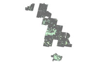
| Forest and Land Cover Type 1975 and 1993 (overlaid) | |
|
|
Data format: SDE Feature Class Coordinate system: Indian_1960_UTM_Zone_48N Location: Server=mekserv3; Service=5153; Database=mrc; User=sde; Version=sde.DEFAULT |
|
Abstract:
Forest and Land Cover Type 1975 and 1993 (overlaid) |
|
Metadata elements shown with blue text are defined in the International Organization for Standardization's (ISO) document 19115 Geographic Information - Metadata. Elements shown with green text are defined by ESRI and will be documented as extentions to the ISO 19115. Elements shown with a green asterisk (*) will be automatically updated by ArcCatalog.
No.184, Unit 18, Fa Ngoum Rd., Ban Sithane Neua
No.184, Unit 18, Fa Ngoum Rd., Ban Sithane Neua
No.184, Unit 18, Fa Ngoum Rd., Ban Sithane Neua
Forest and Land Cover Type 1975 and 1993 (overlaid)
No.184, Unit 18, Fa Ngoum Rd., Ban Sithane Neua
AREA -------------------------

Lower Mekong Basin, including:
- Cambodia (some areas in the LMB)
- Laos (some areas in the LMB)
- Thailand (some areas in the LMB)
- Vietnam (some areas in the LMB)

DESCRIPTION-------------------


forest & land cover 1975 and 1993 (overlaid)


SOURCE MAP--------------------


[NON]


SOURCE DATA SET---------------

[NON]

SOURCE AGENCY-----------------

Forest Cover Monitoring Project (GTZ)
Mekong River Commission Secretariat

GENERATION--------------------

Dataset was created by MRCS - GTZ


STATUS------------------------

Last updated: Forest Cover Monitoring Project, Dr. K. Panzer Februray 1999
Completion status: 100 %

COMMENTS----------------------

[NON]

DOCUMENTATION-----------------

Operator:	Kunthea NUON
Date:	22 Oct 2001

UNITS ------------------------

Map Units:	meters
System:		UTM, Zone 48, Spheroid Everest
Datum:		Indian 1960

FORMAT------------------------

Original format: WS Arc/Info Coverage
Vector (Polygon)


POLYGON ATTRIBUTE TABLE--------------------

LMB7593_ID       unique, no meaning

F93              forest cover / land cover type 1993
*                FOREST
11               Evergreen, high cover density
12               Evergreen, medium - low cover density
13               Evergreen mosaic
17               Mixed (evergreen and deciduous), high cover density
18               Mixed (evergreen and deciduous) medium - low cover density
19               Mixed mosaic
20               Deciduous
22               Deciduous mosaic
40               Regrowth
41               Regrowth, inundated
52               Inundated
53               Mangrove
54               Plantations
55               Other
56               Inundated mosaic
*                NON-FOREST
61               Wood- and shrubland, evergreen
62               Grassland
63               Bamboo
64               Wood- and shrubland, dry
65               Wood- and shrubland, inundated
81               Cropping mosaic, cropping area <30%
82               Cropping mosaic, cropping area >30%
91               Agricultural land
92               Barren land
93               Rocks
94               Urban or built-over area
95               Water
96               Wetland
97               Other
99               Clouds

F75              forest cover / land cover type 1975
*                FOREST
1                Forest
*                NON-FOREST
2                Non-Forest
9                Clouds / Heavily Flooded Areas

RF93             forest cover / land cover type 1993, reclassified
*                FOREST
1                Forest
                 (contains F93 = 11,12,13,17,18,19,20,22,40,41,52,53,54,55,56)
*                NON-FOREST
2                Non-Forest
                 (contains F93 = 61,62,63,64,65,81,82,91,92,93,94,95,96,97)
3                Clouds
                 (contains F93 = 99)

RF75             forest cover / land cover type 1975, reclassified
*                FOREST
1                Forest
                 (contains F75 = 1)
*                NON-FOREST
2                Non-Forest
                 (contains F75 = 2)
3                Clouds / Heavily Flooded Areas
                 (contains F75 = 9)

COMBI            combination of RF75 and RF93
                 (COMBI = ( RF75 * 10 ) + RF93)

CCODE          country
1                Cambodia
2                Laos
3                Thailand
4                Vietnam
No.184, Unit 18, Fa Ngoum Rd., Ban Sithane Neua
Visit http://www.mrcmekong.org