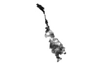
Data format: SDE Raster Dataset
Coordinate system: Indian_1954_UTM_Zone_48N
Location: Server=mekserv3; Service=5153; Database=mrc; User=sde; Version=sde.DEFAULT
| Mean Rainfall in May 2002 | |

|
Data format: SDE Raster Dataset Coordinate system: Indian_1954_UTM_Zone_48N Location: Server=mekserv3; Service=5153; Database=mrc; User=sde; Version=sde.DEFAULT |
|
Abstract:
Mean Rainfall in May 2002

Satellite rainfall estimate from NOAA |
|
Metadata elements shown with blue text are defined in the International Organization for Standardization's (ISO) document 19115 Geographic Information - Metadata. Elements shown with green text are defined by ESRI and will be documented as extentions to the ISO 19115. Elements shown with a green asterisk (*) will be automatically updated by ArcCatalog.
No.184, Unit 18, Fa Ngoum Rd., Ban Sithane Neua
No.184, Unit 18, Fa Ngoum Rd., Ban Sithane Neua
No.184, Unit 18, Fa Ngoum Rd., Ban Sithane Neua
No.184, Unit 18, Fa Ngoum Rd., Ban Sithane Neua
Mean Rainfall in May 2002 Satellite rainfall estimate from NOAA
No.184, Unit 18, Fa Ngoum Rd., Ban Sithane Neua
AREA :
Mekong Basin, including:
- Cambodia (LMB part)
- Laos (LMB part)
- Thailand (LMB part)
- Vietnam (LMB part)
- Myanmar (LMB part)
- China (LMB part);

SOURCE DATA SET :
The data set is derived from 1-km National Oceanic and Atmospheric Administration (NOAA).
http://kauai.nrlmry.navy.mil/sat_products.html;

SOURCE AGENCY :
USGS EROS Data Center;

GENERATION :
Generation of the original data:
Daily rainfall estimate from NOAA estimates are made on a 0.1 degree grid (approximately 10 Km).
Original maps were reprojected from geogrphic to UTM Indian60.
Dataset was cliped from the orginal USGS dataset by Mekong Basin boundary (gb-bnd)
Monthly mean rainfall were optained from suming-up of daily rainfall estimate;

STATUS :
Last update: May 2003 by Manithaphone Mahaxay
Completion status: 100 %;

RASTER :
Resolution: 10,000 meters cell size;

VALUE ATTRIBUTE TABLE (vat) for grids :
Value	Mean rainfall in milimeter.
P.O. Box 6101
Visit http://www.mrcmekong.org
