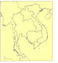
Data format: SDE Feature Class
Coordinate system: Indian_1960_UTM_Zone_48N
Location: Server=mekserv3
| Country Boundary | |

|
Data format: SDE Feature Class Coordinate system: Indian_1960_UTM_Zone_48N Location: Server=mekserv3 |
|
Abstract:
Administrative boundary.

(Only Cambodia, Lao PDR, Thailand, and Viet Nam contain administrative boundary at 3 different levels, district, province and country. ) |
|
Metadata elements shown with blue text are defined in the International Organization for Standardization's (ISO) document 19115 Geographic Information - Metadata. Elements shown with green text are defined by ESRI and will be documented as extentions to the ISO 19115. Elements shown with a green asterisk (*) will be automatically updated by ArcCatalog.
No.184, Unit 18, Fa Ngoum Rd., Ban Sithane Neua
No.184, Unit 18, Fa Ngoum Rd., Ban Sithane Neua
No.184, Unit 18, Fa Ngoum Rd., Ban Sithane Neua
No.184, Unit 18, Fa Ngoum Rd., Ban Sithane Neua
Administrative boundary. (Only Cambodia, Lao PDR, Thailand, and Viet Nam contain administrative boundary at 3 different levels, district, province and country. )
No.184, Unit 18, Fa Ngoum Rd., Ban Sithane Neua
AREA -------------------------

Cambodia, Lao PDR, Thailand, and Viet Nam

DESCRIPTION ------------------

Only Cambodia, Lao PDR, Thailand, and Viet Nam contain administrative boundary at 3 different levels, district, province and country.

SOURCE MAP -------------------

Cambodia: 	All boundaries from 50,000 scale topomaps.

Laos: 		Country boundary mainly 50,000 scale topomaps, some 100,000 scale topomaps. Province and district boundaries 100,000 scale topomaps.

Thailand: 	Boundary to Laos and Cambodia 50,000 scale topomaps and other parts 100,000 scale topomaps. Province and district boundaries 250,000 scale topomaps.

Viet Nam:	Boundary to Laos and Cambodia 50,000 scale topomaps, the rest 250th

China:          Boundary to Laos 50,000 scale topomaps and to Thailand 100,000 scale topomaps, the rest 250,000 topomaps

Myanmar:        Boundary to Laos 50,000 scale topomaps and to Thailand 100,000 scale topomaps, the rest 250,000 topomaps

Others		Digital chart of the world


SOURCE DATA SET --------------

Cambodia: National Department of Geography

Laos: National Geographic Department

Thailand: Province and District datasets were received from FP/AMFC-Udon Thani. Souce datset could perhap be NRD2C, by National Statistic Office, Ministry of Interior.

Viet Nam: Province and District boundarie were received from Mr. Tinh Ngoc Dang (MRC Hydrologist) who claims that the data were extract from the Digital Atlas of Viet Nam, 2000 published by Cartographic Publishing House - Ministry of Natural Resources and Environment (agency info. from VNMC)

SOURCE AGENCY ----------------

--

GENERATION -------------------

Country boundary and district boundary (of 4 countries) were unioned. The unnecessary items were dropped. Boundary lines are coded to distinguish the admin boundary types.


STATUS -----------------------

All geographic features are completed. All attributes are filled.
Last Update - 11 November 2004


COMMENTS ---------------------

The boundaries should not be considered authoritative.

DOCUMENTATION ----------------

Operator: Penroong B.
Date: 24 November 2004

UNITS ------------------------

System: UTM Zone 48
Map unit: meters
Datum: Indian 1960
Spheroid: Everest

FORMAT -----------------------

SDE 9.x
Feature type: polygon

POLYGON ATTRIBUTES -----------

CCODE - Country code
P.O. Box 6101
Visit http://www.mrcmekong.org