3. The 2005 Flood (cont')
3.2 Hydrological analysis of the 2005 flood (cont')
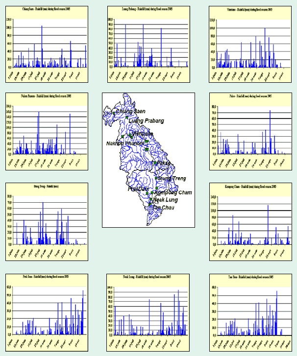
Figure 10: Rainfall during the flood
period 2005 at major hydrological stations along the Mekong
River
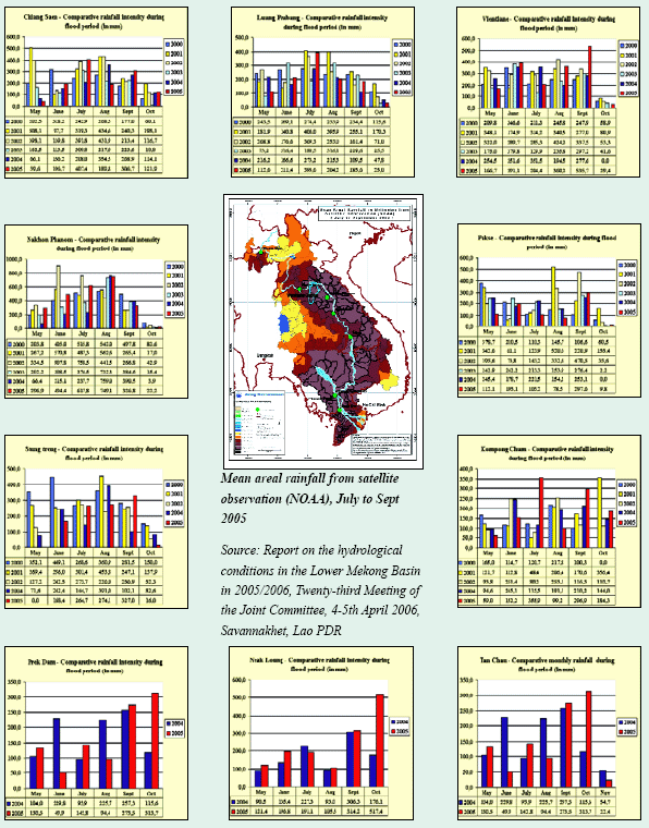
Figure 11: Comparative rainfall intensity
in mm/month at major hydrological stations along the Mekong
River
The available values of the maximum discharge recorded in 2005
along the Mekong mainstream are shown in
Figure 12. This dataset is an estimate prepared by the Technical
Support Division of the MRCS (not validated by
the countries) on a basis of the operational water level data
received daily during in the flood season and the most
recent rating curves available at MRCS.
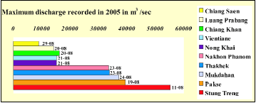
Figure 12: Maximum discharge recorded
in 2005 along the Mekong mainstream
The analysis of the hydrographs shows a general drop in the
water level of the Mekong in the first half of July.
The explanation seems to be that no or low rainfall occurred
from the last week of June until approximately 10th
July in most of the upper sections of the LMB (see Figure 13).
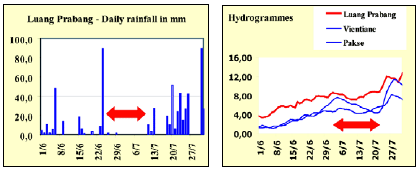
Figure 13: Drop in the water level in
the Mekong River in the first week of July 2005.
The speed with which the water in the Mekong rises is an interesting parameter to analyse. The graphs show that in some places the Mekong may rise more than 1.5m in one day which may be critical for preparedness if no adequate warning information is provided. An interesting finding is also the behaviour of the "early flood" in the Mekong Delta represented by showing the rapid fluctuation of the water level in both Neak Long and Tan Chau hydrostations (Figure 14). At the end of July, two days of rapidly rising water levels were recorded. This singularity may also be seen on all similar graphics from Thakek down to the delta. By the end of July, early heavy rainfalls had occurred in the upper part of the basin, causing rapid rises in the water level, but coupled with poor possibilities of lateral extension for water storage.
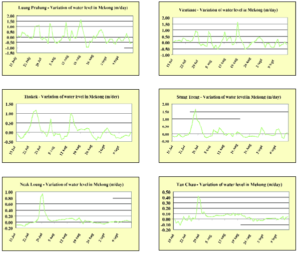
Figure 14: Velocity of water level rises
at major hydrological stations along the MekongRiver.
Choose a newsletter: