Navigating trade and commerce - the Navigation Programme (NAP)

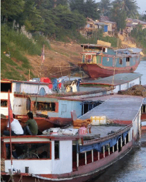
The Mekong River is an important gateway to trade centres in the Southeast Asian region and the rest of the world. Despite a predicted short-term slump in demand due to the global economic crisis, sustained growth in inland water trade along the Mekong River continues to be evident, with a significant increase in container traffic in Cambodia and Viet Nam. In a few years time, container movements at Phnom Penh Port will increase from around 8,000 to more than 50,000 containers annually. The Mekong route between China and Thailand is also proving to be a vital transport corridor for trade in the region. At least 260,000 tonnes of cargo per year are transported between Thailand and Yunnan province in China via the Lancang-Mekong River. Due to the increasing amount of traffic along these trade routes, it is critical that environmental and social considerations are integrated in planning and development.
In comparison with other cargo routes, inland waterway transport has comparatively less impact on the environment. It is estimated that on the Yunnan-Bangkok multi-modal transport route, annual savings in fuel consumption with current transport volumes are about 4.5 million litres, corresponding with a reduction of 12,400 tons of CO2- emissions, not to mention the decrease in vehicles on the roads, less pollution and fewer traffic accidents.
Growth in river traffic is expected to continue with the provision of legal frameworks for trade and new navigation infrastructure. Nonetheless, in many parts, the Mekong River has not yet been exploited for its potential to boost trade relations and income for countries in the Basin. A regional development approach is needed to contribute to poverty reduction and sustainable development of the Mekong Region.

One of the strategic objectives of the MRC Navigation Programme is to promote freedom of navigation and increase the international trade opportunities for the MRC Member Countries' mutual benefit, and to assist in coordination and cooperation in developing effective and safe waterborne transport routes in a sustainable and protective manner.
Development of navigation is taking place through the following five components of the Programme:
- Socio-Economic Analysis and Regional Transport Planning;
- Legal Framework for Cross-border Navigation;
- Traffic Safety and Environmental Sustainability;
- Information Promotion and Coordination; and
- Institutional Development
Transport Planning for Navigation
In 2008 the MRC conducted surveys of several selected river
stretches to identify areas that may be dangerous to navigation.
High resolution images were gathered between Luang Prabang and
Pakse and a number of areas posing high risk to navigation safety
were identified and charted. This information will be used to
help install river channel markers.
Studies were also conducted into the economic potential of waterway transport and the potential impact that mainstream dams will have on navigation, particularly in the Upper Mekong River.
A second study to recommend standard specifications for ship locks on proposed Mekong mainstream dams was also carried out. These specifications will help hydropower planners to ensure that any future dams would not become an impediment to navigation and the freedom of navigation required by the 1995 Mekong Agreement would be upheld.
Legal Framework for Cross-Border Navigation
In 2008, the final stage of facilitation in the negotiations
between Cambodia and Viet Nam on a draft agreement for cross-border
waterway transportation was reached. By the end of the year,
both parties were consulting with their respective governments
for approval.
Aids to Navigation Systems
Using information collected by navigation surveys, three new
projects to aid navigation between Vientiane and Luang Prabang,
as well as between Phnom Penh and Kampong Cham were planned
in 2008. Technical workshops with riparian staff involved in
the inland waterway transport sector were held in December,
resulting in a navigation channel plan. A tendering process
is currently underway and the aids to navigation systems are
scheduled for installation in 2009.

Mekong River Navigation Information Systems
Projects to improve the information available to the Mekong
navigation industry also progressed throughout the year, including
a regional River Information System (RIS) that will provide
planners, decision makers and waterway users with reliable and
accurate navigation data. In 2008, two tidal stations were established
in conjunction with HYCOS (see page 23) at Cua Tieu (Mekong
Estuary) and Dinh An (Bassac Estuary) in Viet Nam. Shipmasters
and pilots in the estuaries now have access to information on
water levels available in almost real time. This is of particular
importance for larger ships that can only pass the sand bar
at sea during high tide.
Also in 2008, tendering began for the establishment of an Automatic Identification System (AIS) on the Mekong River between Phnom Penh and the border of Cambodia and Viet Nam. This will allow the tracking of vessel movements on this stretch of river resulting in improved efficiency and safer transport.
Support to Line Agencies
Following the establishment of the Navigation Advisory Body
in 2007, four National Navigation Coordinators have been recruited
and are now fully involved in the activities of the programme.
The body had its fourth meeting in Thailand in June 2008.
Regional Cooperation
MRC also carried out activities to promote and coordinate development
of the navigation sector. The first joint seminar with Chinese
Authorities, on Waterway Safety and Navigation Improvement was
held in Jinghong, Yunnan Province, China on 14-16 October 2008.
Another seminar relating to sustainable development of navigation
along the Mekong River is planned for 2009.
Choose a newsletter: