The focus of the project is the full length of the Danube River with its floodplains
and some important tributaries. The research builds on preliminary results of
the "Macrophytes” Expert Group of the International Association for
Danube Research (IAD, see separate article) and the "Pilot Study Danube”
which was financed by the Austrian National Committee of IAD. Results of this
first survey were published in "Archive of Hydrobiology Supplement Large
Rivers” (July 2003, www.schweizerbart.de).
 |
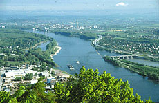
| View of the Danube River from Leopoldsberg (Vienna, Austria) |
Macrophytes are aquatic plants – including large algae, liverworts, mosses and higher plants - which can in most cases be determined to species level with the naked eye. Macrophytes and their habitat are important for a number of reasons:
• They provide essential physical structures within a water body, like a forest does in the terrestrial world; numerous aquatic organisms walk, graze, hunt, seek shelter or swim either on the surface of the water plants or within the spaces created by their delicate stems, branches and leaves.
• They are an important indicator of biological quality, which was neglected in the past, but the EU Water Framework Directive now requires their monitoring.
• Aquatic plants highly contribute to biodiversity in rivers and floodplains, which is also recognised by the UN-Convention on Biological Diversity and red lists of endangered species.
• Macrophytes are clear biological indicators of human impact on water bodies.
 |
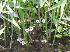
| Arrow head, frog-bite, hornwort and bur-reed in a Danube oxbow |
Since all 2850 km of the Danube River and some of its major tributaries are
subject of the investigation, the standardisation of the methodology is the main
challenge for the international team of scientists collaborating under the MIDCC:
central data processing is therefore crucial, relying to a great extent on Internet
tools made available to all partners in real time.
Essential features of the MIDCC project include:
The project is ambitious in scale since it covers the entire 2850-kilometer length of the Danube River and some of its important tributaries (spatial resolution: 1 river km).
• The applied methodology follows the guidelines of the European Committee for Standardisation (CEN Standards) and meets the monitoring requirements of the EU Water Framework Directive. The standardised methodology ensures a high level of comparability, which cannot be reached in individualised studies.
• The project will lead to an immense collection of data and information on parameters of the river littoral and the surrounding landscape. Digital images, herbarium and collections of alcohol-preserved specimen of aquatic plants will be prepared together with a typology and documentation of the different habitat types (e.g. types of connectivity between main channel and floodplain water bodies).
• The scale of the working map is 1:50,000. The GIS-based results can therefore support the regional planning activities and assist the development of sustainable management of ecologically sensitive river stretches.
 |
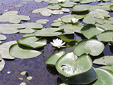
| Water lilies and hornwort: a typical plant community |
 |
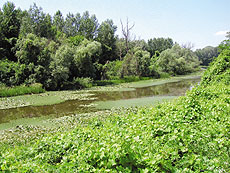
| An oxbow in a late state of succession |
Project teams are spread across the Danube Basin. They are located in Germany,
Austria (lead partner), Slovakia, Hungary, Slovenia, Croatia, Serbia and Montenegro,
Bulgaria, and Romania.
The fieldwork in 2002 already covered about 1,800 kilometres along the main river,
floodplain waters and man-made canals. Some findings are similar to those yielded
by the ICPDR Joint Danube Survey (see Danube Watch 01/2002), e.g. both studies
found Hornwort (Ceratophyllum demersum) the most widespread aquatic species. On
the other hand, the massive occurrence of an alien species such as Cabomba caroliniana
in the Hungarian stretch was completely unexpected.
The project is currently running on schedule. A first summary of the work will
be made available to the public on the Internet by September 2003 and the final
results will be published and discussed openly in a Symposium in 2005. The MIDCC
project will be recognised as a new platform for assessing and documenting biological
data in the Danube catchment thus contributing to the implementation of the EU
Water Framework Directive.