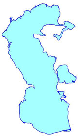
Coastline of the Caspian Sea
  coast_ascii.zip (48 Kb) coast_ascii.zip (48 Kb)
Title of the file: coastline.txt
Units: geographical coordinates - decimal degree (WGS 84).
Introduction: Coastline is used for showing the contours
of the seas and includes the coastlines of the islands.
Date of creation (last revision): May, 1999.
Used dataset: The coastline was digitized from the
Navigation Map of the Caspian Sea published by the Navigation and Oceanography Department
of the Defense Ministry of the USSR in 1987. (Scale 1:1000000, Mercator projection) and
was corrected in some details using the image from the satellite "Resurs" made
in 1997. Resolution of the image is 150 m.
Method and the software used for map creation: The coastline obtained by digitizing the
paper map and the satellite image in Arc View GIS 3.1 (ESRI).
coast_surfer.zip (77 Kb)
Title of the file: coastline.srf.
Layers: Coast - the main coastline of the Caspian Sea,
Islands - the coastlines of the islands.
Units: geographical coordinates - decimal degree (WGS 84).
Introduction: Coastline is used for showing the contours of
the seas and includes the coastlines of the islands.
Date of creation (last revision): May, 1999.
Used dataset: The coastline was digitized from the
Navigation Map of the Caspian Sea published by the Navigation and Oceanography Department
of the Defense Ministry of the USSR in 1987. (Scale 1:1000000, Mercator projection) and
was corrected using the image from the satellite "Resurs" made in 1997.
Resolution of the image is 150 m.
Method and software used for map creation: The coastline
obtained by digitizing the paper map and the satellite image in Arc View GIS 3.1 (ESRI)
and importing it into Surfer 7.00 software (Golden Software, Inc.).
coast_shapes.zip (83 Kb)
Title of the file: coastline.shp - (Poligonal theme in the
format of the Arc View Gis software of the ESRI company).
Units: geographical coordinates - decimal degree (WGS 84).
Introduction: Coastline is used for showing the contours of the seas and includes the
coastlines of the islands.
Date of creation (last revision): May, 1999.
Used dataset: The coastline was digitized from the Navigation Map of the Caspian Sea
published by the Navigation and Oceanography Department of the Defense Ministry of the
USSR in 1987. (Scale 1:1000000, Mercator projection) and was corrected in some details
using the image from the satellite "Resurs" made in 1997. Resolution of the
image is 150 m.
Method and the software used for map creation: The coastline obtained by digitizing the
paper map and the satellite image in Arc View GIS 3.1 (ESRI).
Isolines of the bathymetry of the
Caspian Sea
 isobat_ascii.zip (1.2 Mb) isobat_ascii.zip (1.2 Mb)
Titles of the files: isobat0005.txt - depth 5 m,
isobat0010.txt - depth 10 m,
isobat0020.txt - depth 20 m,
isobat0050.txt - depth 50 m,
isobat0100.txt - depth 100 m,
isobat0200.txt - depth 200 m,
isobat0300.txt - depth 300 m,
isobat0400.txt - depth 400 m,
isobat0500.txt - depth 500 m,
isobat0600.txt - depth 600 m,
isobat0700.txt - depth 700 m,
isobat0800.txt - depth 800 m,
isobat0900.txt - depth 900 m,
isobat1000.txt - depth 1000 m.
Units: geographical coordinates - decimal degree (WGS 84),
depth data - meter.
Introduction: Isolines of the bathymetry is used for showing the depth of the seas.
Date of creation (last revision): July 1999.
Used dataset: The Navigation Map published by the Navigation and Oceanography Department
of the Defense Ministry of the USSR in 1987. Scale 1:1000000. Mercator projection.
Method and the software used for map creation: The depth data obtained by digitizing the
map in Arc View GIS 3.1 (ESRI). The depth isolines are created using the Spatial Analyst
1.1 extension of the Arc View GIS.
isobat_surfer.zip (461 Kb)
Title of the file: Depth.srf
Levels of the isolines: 5m; 10m; 20m; 50m; 100m(1000m (by
the 100 m interval).
Units: geographical coordinates - decimal degree (WGS 84), depth data - meter.
Introduction: Isolines of the bathymetry is used for showing the depth of the seas.
Date of creation (last revision): July 1999.
Used dataset: The Navigation Map published by the Navigation and Oceanography Department
of the Defense Ministry of the USSR in 1987. Scale 1:1000000. Mercator projection.
Method and software used for map creation: The depth data obtained by digitizing the map
in Arc View GIS 3.1 (ESRI). The depth isolines created using the Surfer 7.00 software
(Golden Software, Inc.)
The data interpolation method: Kriging.
Grid size: 200 Rows X 156 Columns.
isobat_shapes.zip (2 Mb)
Titles of the files: Ctour1.shp - depth 5 m, (linear theme
in the format of the Arc View Gis software of the ESRI company),
Ctour2.shp - depth 10 m, (linear theme),
Ctour3.shp - depth 20 m, (linear theme),
Ctour4.shp - depth 50 m, (linear theme),
Ctour5.shp - depths 100-1000 m, interval 100 m, (linear theme).
Units: geographical coordinates - decimal degree (WGS 84), depth data - meter.
Introduction: Isolines of the bathymetry is used for showing the depth of the seas.
Date of creation (last revision): July 1999.
Used dataset: The Navigation Map published by the Navigation and Oceanography Department
of the Defense Ministry of the USSR in 1987. Scale 1:1000000. Mercator projection.
Method and the software used for map creation: The depth data obtained by digitizing the
map in Arc View GIS 3.1 (ESRI). The depth isolines are created using the Spatial Analyst
1.1 extension of the Arc View GIS.
Blank Map of the Caspian Sea Region
 |
 |
| Full blank map |
Simple blank map
(only coast line) |
Titles of the files:
caspian_rast_a3.jpg (599 Kb) (A3 format),
caspian_rast_a3_simple.jpg (132 Kb) (A3 format),
caspian_rast_a4.jpg (396 Kb) (A4 format),
caspian_rast_a4_simple.jpg (91 Kb) (A4 format),
Caspian.zip
(2,4 Mb) (in Arc View GIS 3.2 format).
Projection properties: Geographical coordinates - decimal
degree (WGS 84).
Projection - Equidistant Cylindrical,
Central Meridian - 50.5°.
Reference Latitude - 42°
Introduction: The blank map of the Caspian Sea is used to
manually prepare geographical information for its further digitizing.
Date of creation: March 2001.
Used dataset: The coastline and the bathymetry data were
digitized from the Navigation Map of the Caspian Sea published by the Navigation and
Oceanography Department of the Defense Ministry of the USSR in 1987. (Scale 1:1000000,
Mercator projection). The coastline was corrected in some details using the image from the
satellite "Resurs" made in 1997. Resolution of the image is 150 m.
Method and the software used for map creation: The map was
created using the Arc View GIS 3.2 (ESRI) software. The depth isolines are created using
the Spatial Analyst 2.0 extension of the Arc View GIS.
Author: Ziyafat Kerimov (Caspian
Environment Program).
Address for correspondence:
PCU of Caspian Environment Program
Room 108, Government Building
U.Hajibekov str., 40, Baku-370016, Azerbaijan
Phone: +994 12 97 17 85
Fax: +994 12 97 17 86
E-mail: zkerimov@caspian.in-baku.com
Notice
Any usage of data and maps from this web site in
publications must be acknowledged as follows: "The data (map, part of the data) used
in this publication originate from the Caspian Environment Programme |
Disclaimer
Data presented here has been provided by a range of the
groups and sources. While every effort has been made to ensure accuracy and completeness,
no guarantee is given, nor responsibility taken by the Caspian Environment Programme (CEP)
for errors or omissions in these data and the CEP does not accept responsibility in
respect of any information or advice given in relation to or as a consequence of anything
contained herein. |
|